About NOAA Buoys Stations & Ships
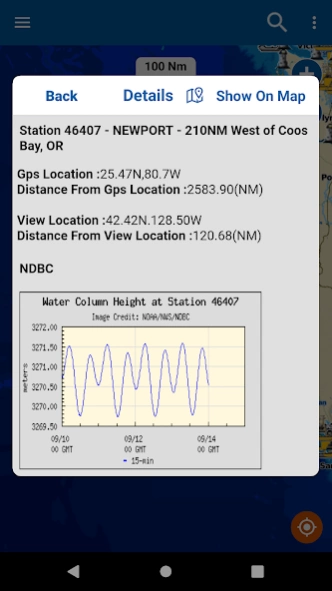
NOAA Buoy data viewer allows you to retrieve info like tides, wave height and period, wind speed and direction, air and water temperature, humidity, dew point, atmospheric pressure, rising and falling indicator,...
NOAA Buoy data viewer allows you to retrieve info like tides, wave height and period, wind speed and direction, air and water temperature, humidity, dew point, atmospheric pressure, rising and falling indicator, visibility, tsunami and typhoon warnings on the detailed marine chart thanks to viewer.flytomap.com
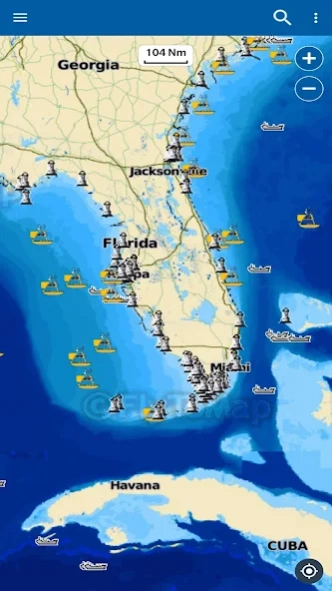
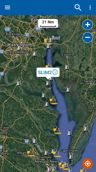
All buoy stations & ships are displayed on the world map based on the user’s current location while boating.
Sailors & Mariners can find the nearest buoy station &ships showing station name, ship name, date, time along with their respective icons.
Just tap and get the info you require.
Advise and info are coming directly from NOAA's National Data Buoy Center.
A must for boaters, sailors, anglers and divers.
Detailed Features:
* User friendly and easy to handle
* All buoy stations and ships are shown on the map based on the user’s current location
* By taping on the Icons detailed information is displayed
* By taping on GPS Icon the present location on the map is shown
* Detailed live buoy data with access to location specific forecasts.
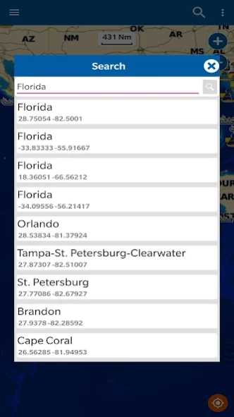
* Buoys sorted by proximity to your selected location.
* Tide Predictions.
* Moon phases.
* Zoom, Rotate and Pan fast just by a finger touch.
Follow us:
▶Twitter @flytomap
▶Web Site flytomap.com
▶Web App viewer.flytomap.com
▶Facebook facebook.com/flytomap
**For the buoy locations available on NOAA BUOY app, go here: http://www.ndbc.noaa.gov/
NOTE :
“ The information provided on this app is for reference only .”
“ Continued use of GPS running in the back ground can decrease battery Life”
“Turn off GPS when not in use”
Previous Versions
Here you can find the changelog of NOAA Buoys Stations & Ships since it was posted on our website on 2016-10-09 18:58:24.
The latest version is 1.5.3 and it was updated on 2024-04-19 17:50:35. See below the changes in each version.
NOAA Buoys Stations & Ships version 1.5.3
Updated At: 2022-01-06
Changes: Gui Enhanced
performance improved
NOAA Buoys Stations & Ships version 1.0
Updated At: 2016-09-19
Disclaimer
Official Google Play Link
We do not host NOAA Buoys Stations & Ships on our servers. We did not scan it for viruses, adware, spyware or other type of malware. This app is hosted by Google and passed their terms and conditions to be listed there. We recommend caution when installing it.
The Google Play link for NOAA Buoys Stations & Ships is provided to you by apps112.com without any warranties, representations or guarantees of any kind, so access it at your own risk.
If you have questions regarding this particular app contact the publisher directly. For questions about the functionalities of apps112.com contact us.